
At a glance
Pakistan’s mountain regions reward unhurried travel: village walks, terraced fields, forest trails and changing views can be as memorable as a summit. Choose a trip around your fitness, available time and comfort with rough roads rather than trying to include every famous valley.
May to October is a useful general planning window for northern travel, but conditions vary with elevation and region. Early-season snow and later autumn storms can limit trails. High passes commonly face winter closures; an open valley road does not mean that a pass or trekking route is accessible.
Build the journey around one main valley and a flexible side excursion. Allow recovery time after long road travel and choose shorter walks before attempting demanding days. A village-based holiday can provide a rewarding alternative when snow, poor visibility or individual fitness makes higher terrain unsuitable.
Top places to visit
Hunza (Karimabad)
Hunza Valley is a high mountain valley on the Karakoram Highway, known for Baltit and Altit forts in Karimabad and the turquoise Attabad Lake. It is surrounded by peaks including Rakaposhi and Ultar Sar.
Skardu
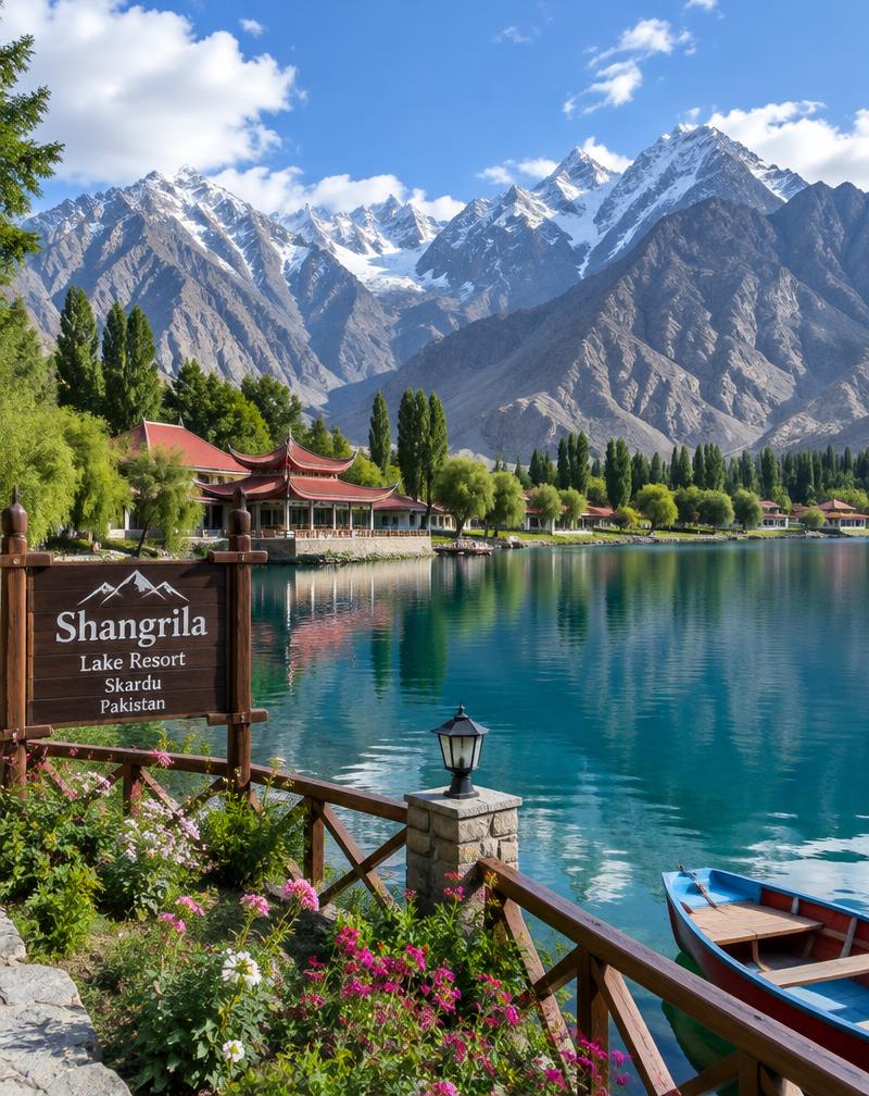
Skardu is the main town of Baltistan and a gateway to the Karakoram's highest peaks. Nearby are the Kachura lakes, including Shangrila, and the historic town of Shigar.
Fairy Meadows
Fairy Meadows is an alpine meadow facing the Rakhiot face of Nanga Parbat, the world's ninth-highest mountain. Access is by jeep track and a hike, and accommodation is simple.
Naran
Naran is the main town of the Kaghan Valley along the Kunhar River in Khyber Pakhtunkhwa. Lake Saiful Muluk lies a short jeep ride above the town.
Swat (Mingora)
Swat Valley in Khyber Pakhtunkhwa is known for its rivers, forests and Buddhist heritage sites. Kalam lies in the upper valley and Malam Jabba is a ski area.
Murree
Murree and the Galiyat are pine-covered hill stations in the hills north of Islamabad. Nathia Gali and Bhurban are popular quieter spots nearby.
Neelum Valley
Neelum Valley in Azad Jammu and Kashmir follows the Neelum River through forested mountains. Villages such as Keran, Sharda and Arang Kel are popular stops.
Chitral
Chitral is a mountain district in northern Khyber Pakhtunkhwa beneath Tirich Mir. The nearby Kalash valleys of Bumburet, Rumbur and Birir are home to the Kalash people.
Deosai Plains
Deosai is a high-altitude plateau and national park between Skardu and Astore. It is covered in wildflowers in summer and is home to the Himalayan brown bear.
Khunjerab Pass
Khunjerab Pass is the high mountain border crossing between Pakistan and China on the Karakoram Highway. It lies within Khunjerab National Park.
Islamabad
Islamabad is Pakistan's capital, set against the Margalla Hills. It is known for the Faisal Mosque, hiking trails and the Pakistan Monument.
Ziarat
Ziarat is a hill station in Balochistan known for its ancient juniper forests. The Quaid-e-Azam Residency is located here.
Shogran
Shogran is a hill plateau above the Kaghan Valley. A jeep track continues to the meadows of Siri and Paye.
Kumrat Valley
Kumrat Valley in Upper Dir is a forested valley along the Panjkora River. Facilities are basic and the road is rough in places.
Khaplu
Khaplu is a town in the Ghanche district of Gilgit-Baltistan along the Shyok River. It is known for the restored Khaplu Palace and the Chaqchan Mosque.
Ratti Gali
Ratti Gali is a high glacial lake in the Neelum Valley of Azad Jammu and Kashmir. It is reached by jeep and a short hike from Dowarian.
Gilgit
Gilgit is the capital of Gilgit-Baltistan and a hub on the Karakoram Highway. It is a common base for trips to Hunza, Skardu and Fairy Meadows.
How to plan
Check current road information, weather forecasts and official travel advisories before departure and again locally. Border areas, restricted valleys and some trekking routes can require permits or other authorisation, especially for foreign visitors. Confirm requirements with the relevant authorities; a booking or guide’s assurance is not itself permission.
Leave spare days before onward flights or important commitments. Ask accommodation providers about heating, drinking water and electricity without assuming these are continuous. Share your route with someone reliable, agree transport arrangements clearly and confirm whether your guide’s experience matches the specific walk rather than general sightseeing.
What to pack
Pack layered clothing, a waterproof outer layer, sun protection and comfortable footwear with dependable grip. Carry a warm hat even in summer, a headlamp, a refillable bottle and a way to treat water. Keep essential medication, identity documents and permit copies accessible in a small day bag.
For overnight trekking, establish who supplies shelter, sleeping equipment, cooking fuel and food before setting out. A sleeping bag suited to expected conditions matters more than a compact appearance. Bring offline maps and spare charging capacity, but do not treat a phone map as a substitute for route knowledge.
Travel safety
Ascend gradually and take symptoms of altitude illness seriously. Headache with nausea, unusual fatigue or dizziness deserves attention; worsening symptoms, confusion or difficulty breathing require urgent help and descent when safe. Do not continue upward simply to preserve an itinerary. Seek medical advice beforehand if you have relevant health conditions.
Avoid exposed ridges during thunderstorms and do not cross fast water to keep a schedule. Landslides, rockfall and changing river levels can interrupt roads and paths. Follow local closures, arrange suitable emergency cover and ask how evacuation would actually work. Carry out rubbish and keep washing away from water sources.
Foreign visitors: some border areas may require permits. Check current travel advisories and entry requirements before travelling.
Travel safety guidanceYour questions, answered
Sources
Last reviewed: